You scroll past “long-range views” and “sunset exposure” on Townsend listings and wonder what they really mean. In the Smokies, a view can be breathtaking one day and muted the next. If you love the idea of a mountain backdrop, you want to be sure the view you buy is the view you’ll enjoy.
This guide translates view language into plain terms, shares simple ways to verify claims before you tour, and outlines on-site checks to confirm what the camera can’t. You will also learn how to assess whether a view is likely to last. Let’s dive in.
Why views vary in Townsend
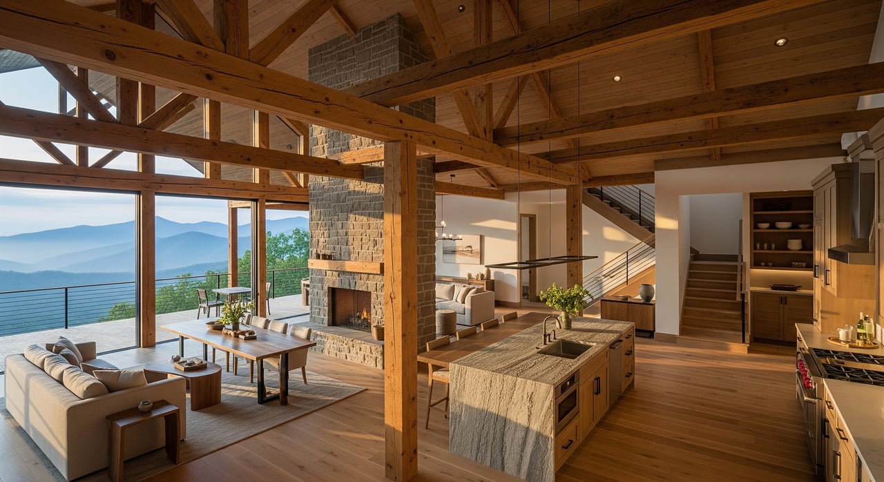
Townsend sits at the eastern foothills of the Great Smoky Mountains, where valleys, hollows, and ridgelines shape what you see from a home site. Properties near or above local ridgelines often have broader sightlines. Homes set in the valley can still have lovely ridge backdrops, but trees and nearby knolls can limit distance.
The Foothills Parkway runs along ridgelines north of Townsend and offers a clear example of long vistas across the Tennessee Valley and toward layered Smoky Mountain ridges. Those wide horizons do not happen by accident. Elevation, orientation, and an unobstructed line of sight all work together.
Atmospheric conditions also matter. Summer can bring humidity and haze that soften distant features. In fall and winter, crisp air and leaf-off conditions often improve perceived distance. Time of day changes contrast too. Low sun angles near sunrise and sunset can light up layers, while midday haze can flatten the view.
Decode common view phrases
Long-range views
“Long-range” usually means you can see far beyond the nearest ridge, often tens of miles on a clear day. It signals both elevation and a clean corridor.
Buyer takeaway:
- Treat “long-range” as qualitative. Listing photos may show the best possible day. Ask how the view looks in humid summer conditions and in leaf-on vs leaf-off seasons.
- Confirm that no intervening ridges or future structures are likely to interrupt the sightline.
Layered ridgelines
“Layers of ridgelines” describe the Smokies’ classic depth effect, with multiple ridges fading into the distance. These are most dramatic when you have some distance from the first ridge and when light is low.
Buyer takeaway:
- Expect the strongest layering at sunrise or sunset and during inversion days. A midafternoon photo may not show the full effect.
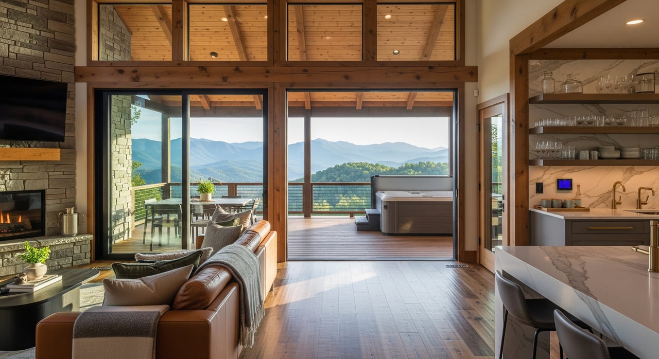
Sunset exposure or western exposure
This means the primary view faces west or roughly west, with the potential for sunsets over the horizon.
Buyer takeaway:
- Verify that trees or nearby homes do not block the western sky. Western slopes can be warmer in late afternoon, which may affect energy use and outdoor comfort.
Panoramic or 360-degree views
“Panoramic” implies a wide, mostly uninterrupted view. True 360-degree views are rare and usually require a knoll-top site with few trees.
Buyer takeaway:
- Ask whether the panorama is continuous or broken by tree lines, power lines, or buildings. Consider how tree growth over time might change the panorama.
Private or seasonal view
A “seasonal view” is better in leaf-off months when deciduous trees are bare. “Private” may mean the view opens through the owner’s trees but is not visible from the road.
Buyer takeaway:
- Ask how often the seller trims or removes trees and whether the HOA or county allows ongoing maintenance.
Verify views online first
You can validate much of a listing’s view story before you step foot on the property. A short pre-check saves time and helps you ask better questions at the showing.
Map elevation and sightlines
- Use Google Earth Pro to create a terrain profile from the property to known ridges or peaks. Elevation cross-sections reveal whether nearer terrain blocks the line of sight.
- Check the image date on satellite photos so you understand when canopy and structures were captured.
- USGS topographic maps and the National Map Viewer help you see contours, saddles, and ridgelines that control sightlines.
Check parcels and zoning
- The Blount County GIS and parcel viewer show lot sizes, parcel lines, and recorded easements. Smaller adjacent lots can be more likely to develop, which could affect future sightlines.
- Look for access roads, right-of-ways, and subdivision patterns that hint at future build-out.
Sun path and seasonality
- Sun position tools such as SunCalc or NOAA solar calculators let you confirm the sunset’s exact azimuth for your preferred time of year.
- Compare the sun’s path to the property’s orientation to see if the western sky is truly open.
Haze and visibility expectations
- Regional air quality and visibility data from state environmental agencies, NOAA, or EPA can help you gauge how often you can expect crisp long-range days versus hazy conditions.
- Local photography and public overlooks can serve as reality checks for how views look in different seasons.
On-site checklist in Townsend
Bring this list when you tour. It will help you see beyond the photos and marketing language.
Visit at the right times
- If the listing mentions sunrise or sunset exposure, schedule showings near those times.
- Try to visit in both clear and humid weather. In the Smokies, summer haze is common and will change how far you can see.
- If timing allows, compare leaf-on and leaf-off seasons to understand how deciduous trees change the view.
Confirm direction and elevation
- Use a phone compass to check the main view’s azimuth. For sunset views, you want a clear west-facing corridor.
- Stand where a future deck or living room window will be. Nearby knolls or tree lines that sit higher than your eye line can limit distance.
Document what you see
- Take wide-angle photos for context and a few telephoto shots to capture distant detail. Save timestamps and note conditions.
- Ask the listing agent for original images and the dates they were taken.
Ask the right questions
- Are there any view or scenic easements recorded on neighboring parcels or this lot?
- Does the HOA or county restrict tree trimming or clearing?
- Have neighbors shared plans to build, add stories, or install towers that could change the view?
- How is dust, seasonal smoke, or agricultural activity in the area at different times of year?
Read listing photos like a pro
Listing photography is marketing. It can be accurate and helpful, but you should know what to watch for.
Red flags
- Only one perfect hero shot, often at sunset, with no daytime or seasonal variety.
- Heavy reliance on telephoto images that compress distance and exaggerate layering without a wide shot for context.
- Vague captions like “stunning views” with no compass direction, no mention of orientation, and no yard or tree height reference.
- Missing exterior angles that would reveal whether trees or neighboring structures intrude on the sightline.
Positive signs
- Multiple photos of the view taken at different times of day and in both leaf-on and leaf-off seasons.
- Aerial or drone images that clearly show surrounding tree heights and the sightline from the home site.
- Captions that state compass direction, such as “primary view faces 260 degrees” or “western exposure” alongside a supporting sunset photo.
- A simple topo sketch or screenshot showing the lot’s elevation and line-of-sight path toward distant ridges.
Will the view last?
In Tennessee, there is no automatic legal right to a view. Lasting protection usually requires recorded instruments or thoughtful planning.
- Easements and covenants. Check the deed, plat, HOA documents, and county records for any view easements or scenic protections. Also look for tree-cutting restrictions that could limit maintenance.
- Zoning and parcel density. County planning maps and parcel data help you evaluate the likelihood of future construction on adjacent lots. Smaller, vacant parcels nearby can signal a higher chance of new builds.
- Park and conservation adjacency. Being near National Park land can safeguard views in that direction, but verify exact boundaries and what lies just outside the park.
- Vegetation and fire safety. Good stewardship matters in mountain settings. Balance tree management for views with defensible-space practices and any local rules on clearing.
- Ongoing maintenance. Even a great view needs care. If the view relies on selective trimming, confirm that the HOA and county allow it and that you can access the trees safely.
Local reference points
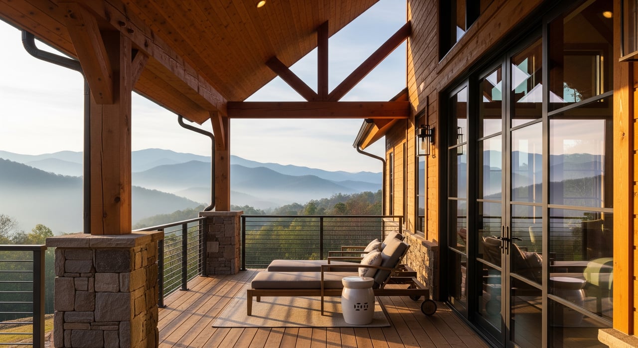
Foothills Parkway overlooks
Use the Foothills Parkway overlooks north of Townsend as a benchmark for what true long-range and layered views look like on clear days. The overlooks offer wide angles across the Tennessee Valley and toward multiple Smoky ridgelines. Compare your property’s orientation and elevation to the parkway’s vantage to calibrate expectations.
Park viewpoints and trails
Public viewpoints in and near Great Smoky Mountains National Park offer useful comparisons in different seasons and light. Visit at various times of day to see how layering changes. Bring a pair of binoculars to understand what level of distant detail feels satisfying to you.
A step-by-step view verification plan
Use this checklist to move from listing to confident decision.
- Pre-check from home
- Pull the lot in Google Earth Pro and trace a line-of-sight to the nearest ridges and distant targets.
- Open USGS topo maps to confirm relative elevations and saddles.
- Review Blount County parcel data for adjacent lot sizes, possible build-out, and recorded easements.
- Use a sun position tool to confirm sunset azimuth for your preferred season.
- Skim recent visibility notes from state or federal sources to set realistic expectations for long-range days.
- On-site due diligence
- Visit at two times of day and, if possible, in two seasons.
- Shoot both wide and telephoto photos, and note conditions.
- Check compass bearings on the main view.
- Talk with neighbors or the HOA about planned changes or maintenance norms.
- Longevity and closing items
- Ask your closing attorney to review title documents for any view or scenic easements, covenants, or tree restrictions.
- Confirm county and HOA rules for view maintenance and defensible space.
- If the lot is steep or complex, consider a surveyor or planner to model sightlines from a proposed building pad.
Work with a local guide
Reading view language is one thing. Proving it and protecting it are another. With local terrain, vegetation, and development patterns in play, a knowledgeable partner saves you time and helps you buy with confidence. Our team understands Smoky Mountain sites from both the brokerage and builder side, and we can guide you through mapping, parcel research, and on-site checks so you know the story behind the photos.
If you are weighing a Townsend property with a view, let’s walk the process together and make a clear plan from offer to closing. Schedule a consultation with David Rasmussen.
FAQs
What does “long-range view” mean in Townsend real estate?
- It usually means you can see well beyond the nearest ridge on clear days, often tens of miles, but clarity varies with season, humidity, and haze.
How can I prove a listing’s “western exposure” before I tour?
- Use a sun position tool to check sunset azimuth for your dates, then confirm with a map or compass that the home’s main view faces that direction.
Can an HOA or easement protect my mountain view long term?
- Yes, but only if protections are recorded. Ask for any view or scenic easements and review HOA covenants and county records during due diligence.
How often will haze affect my Townsend views in summer?
- Summers can be humid and hazy in the Smokies, so expect reduced long-range clarity on typical days and better distance on crisp post-front days.
Are true 360-degree views realistic for cabin lots?
- They are rare and usually require a knoll-top site with few trees and careful maintenance; most properties offer a wide panorama rather than a full 360.